
Hiking Near Asheville

View from the top of Grandfather Mountain
One of the best things about Asheville is its proximity to fantastic hiking! Here are some ideas based on our experience and recommendations we got from locals. You can of course always check out AllTrails!
Blue Ridge Mountains
The Blue Ridge Mountains boast some of the best hiking on the east coast! Gorgeous vistas are already visible from the Blue Ridge Parkway, but trailheads will take you to even more impressive views.
We by no means covered every possible trail, but we really enjoyed these:

The Grandfather’s Profile for which the mountain is named - do you see it? I kinda see it!
Profile Trail to Calloway Peak in Grandfather Mountain State Park
This was my favorite hike that we did while based in Asheville. We found the 1:30 min drive from downtown Asheville to be worthwhile.
Difficult, but no rock scrambling required. Some large steps and several short ladders to climb towards the summit. The top of the trail gets a little less well defined, but signage is still excellent.
8.28 mi out and back to Calloway Peak, including Wautaga viewing point. AllTrails underestimates the hike length by a little over a mile.
Note that there are two routes that go directly to the summit. We went down the wrong way for a bit by mistake! Look for the blue blazes, not white blazes, when you're coming down.
Pro Tip: If you leave enough time, you can hike an extra 1.9 mi each way (so, 3.8 round trip) along the ridge line to the Mile High Swinging Bridge. There is another way to see the bridge, via a trail that requires a $22 entrance fee. You can pay with time and energy expenditure instead, if you prefer.

Black Balsam Knob and Tennent Mountain Loop via Art Loeb Trail: This gorgeous hike is perfect for an active rest day. Not only are you rewarded with panoramic views at Black Balsam Knob and Tennet Mountain's peak, but the trail is largely above the tree line, and you'll have gorgeous views along much of it. The trail does have rocky parts, but nothing too challenging; good hiking boots with ankle support are valuable on this hike, but we didn't need our hiking poles. The trail back was quite wet, so my guess is that you don't want to attempt this trail before mid-April when it's icy. We went April 29 and the weather and trail conditions were ideal.
Moderate
5.2mi loop, 750ft of elevation gain, active hike time 2h 45m
Some bugs, so bring your bug spray
Pro Tip: The Graveyard Fields area is very close by, and there's a beautiful waterfall you can see only 0.2 mi from the parking lot.

Couldn’t make this shit up.
Big Butt Trail to Little Butt and Big Butt, via Point Misery: if you're anything like me, the name of this trail alone is enough of a sell. But in case you want more info, Little Butt features a lovely view and is a great spot for lunch! Jury is still out on whether this trail will increase or decrease the size of your butt. Might depend on the size of your lunch.
Moderate-to-difficult
5 mi out and back to Little Butt
6 mi out and back to Big Butt
Lots of stairs approaching Little Butt
Trail is very well maintained and not technical
Browning Knob and Waterrock Knob: If you want something short but challenging, this is a fantastic hike. The trail is ... shall we say "less straight forward" than most others I encountered in the Blue Ridge Mountains. Keep an eye on the blazes, because it's not always obvious that there is a trail, or that one particular route over huge tree roots and between downed trees is in fact the trail. There is supposedly a plane crash wreck to check out along this trail, but I didn't find it, and I was pressed for time and it was threatening to rain. If you find it, let me know in the comments!
Difficult for terrain, moderate for distance.
1.8 mi out and back
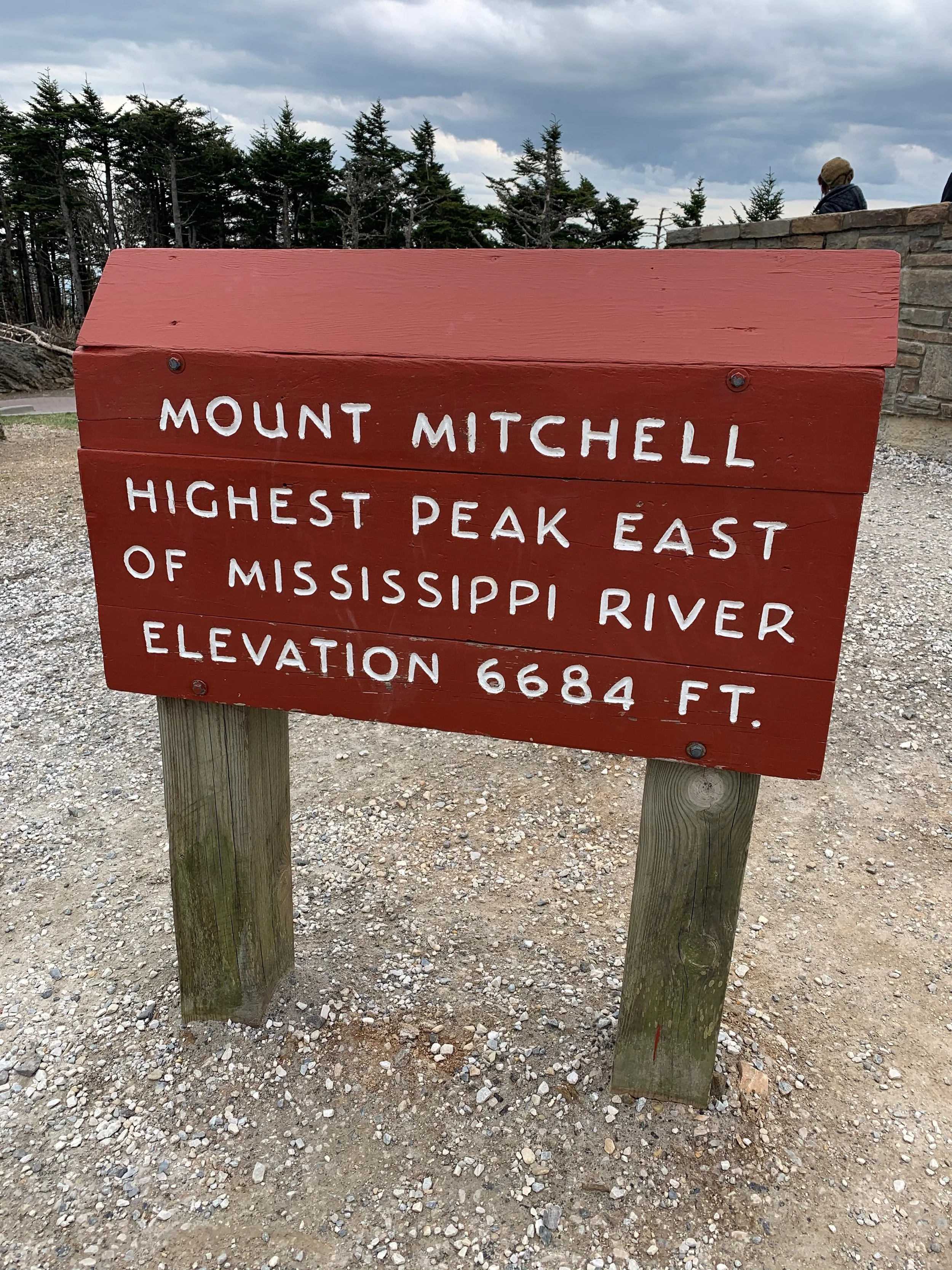


Mt. Mitchell: There are numerous ways to climb Mt. Mitchell. It's along the Appalachian Trail, and there are ~6 and ~9 mile long hikes from various trail heads along the blue ridge parkway. But you should be aware: there is a parking lot 0.4 mi from the top. Personally, when there's a parking lot available, I like to just do the quick trail so I can spend my hiking time getting to somewhere you really can't go otherwise. So, I'd say this peak (the highest east of the Mississippi River!) is definitely worth a stop, but save your legs for other things!
A friend of mine did this loop trail that incorporates a couple of other cool peaks and view points in the park, in addition to stopping at the Mt. Mitchell summit. If you are itching to truly climb Mt. Mitchell, this might be the most fun way!
Some other hikes that have been recommended to me, but I haven't gotten the chance to go yet:
You can also drive about 1.25 hours to the Great Smoky Mountains National Park, where there is really incredible hiking. See my Smokies post for info!